Help
Infrastructure
## **Infrastructure Map Reports** Clicking on the 'Infrastructure Reports' heading on the main menu screen produces this screen:- 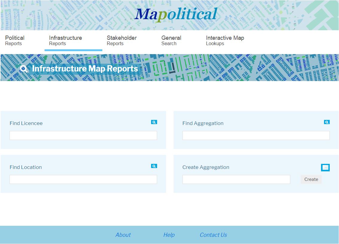 Clients can generate their own political mapping infrastructure within the system and we also offer a service to import infrastructure into Mapolitical. Our term for a route or a number of plotted locations grouped together in the system for reporting purposes is an **'Aggregation'.** This screen therefore shows options for finding client infrastructure located within the system. The options are:- ### **Licencees** Click or Select from the Licencee names available to view the political mapping infrastructure - list of Aggregations and Drawn Boundaries that are available. Click on any of these aggregation and boundary names to view them. Please see either the [Interactive Map Lookup](./interactive map) page for information on producing person reports or editing aggregations and the [Map Draw](./Map Draw) page for further information on producing person reports or editing boundaries. ### **Find Aggregation** Enter part or all of a saved Aggregation name to find the Aggregation of interest. If more that one option is available on the list select the name of interest to view that Aggregation on screen. ### **Find Location** Enter part or all of a saved Location name to find the location of interest. If more that one option is available on the list select the name of interest to [view that Location](./View Location) on screen. ### **Create Aggregation** Use this option to create your own new Aggregation (infrastructure, route etc) in the system. the first step is to enter the name of the new Aggregation in the text box that you would like to create. Clicking the 'Create' button will produce the 'Create Aggregation' screen. On this screen there is the option to amend the Aggregation name that has been entered and the option to enter it's purpose (e.g. Transport Route etc). Then click the 'Create' button to produce the 'Show Aggregation screen' which shows the name and details on the new Aggregation that has been created. This screen also shows the UK map. To enter new location points on the map click on the 'Task' Heading which will produce a list of options. Select the 'Add New Locations' option to start to enter new locations on the [Interactive Map](./interactive map). [Main Help Menu](./index)
About
Privacy
Help
Contact Us